Sell Land Faster with Aerial Views
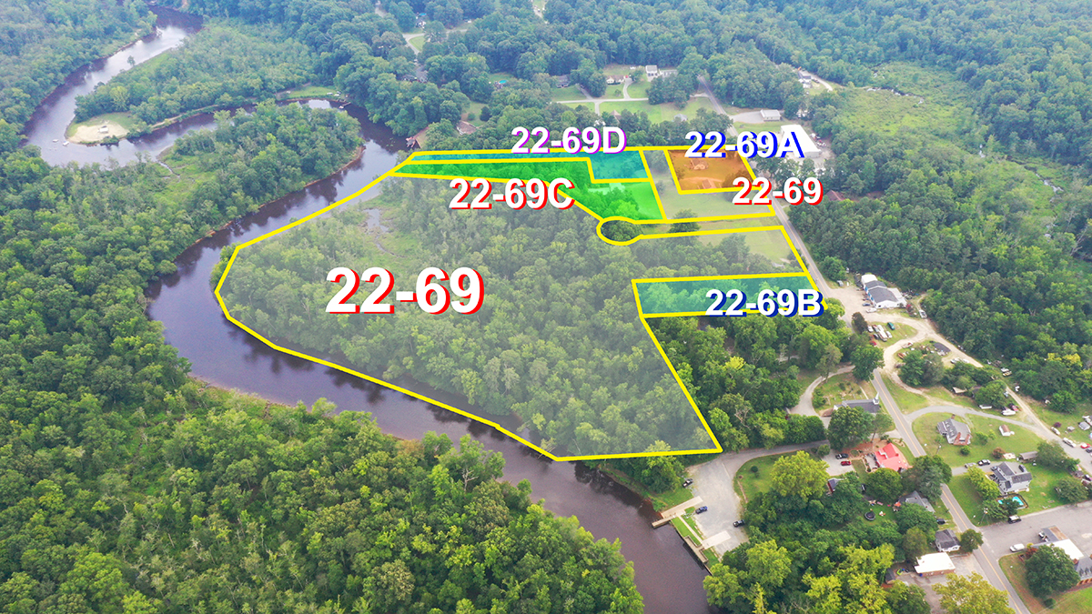
Land buyers want to see the full picture — boundaries, access roads, water features, neighboring properties, and topography. Ground photos cannot capture the scale and context that aerial imagery provides.
We provide high-resolution aerial photography with optional boundary line overlays, ideal for:
- Residential land lots
- Waterfront and lake properties
- Timberland and farmland
- Development parcels
- Recreational land

Portfolio
Recent Land Projects
Boundary-marked aerial photography for properties across Virginia.